Blogging the End of the World™
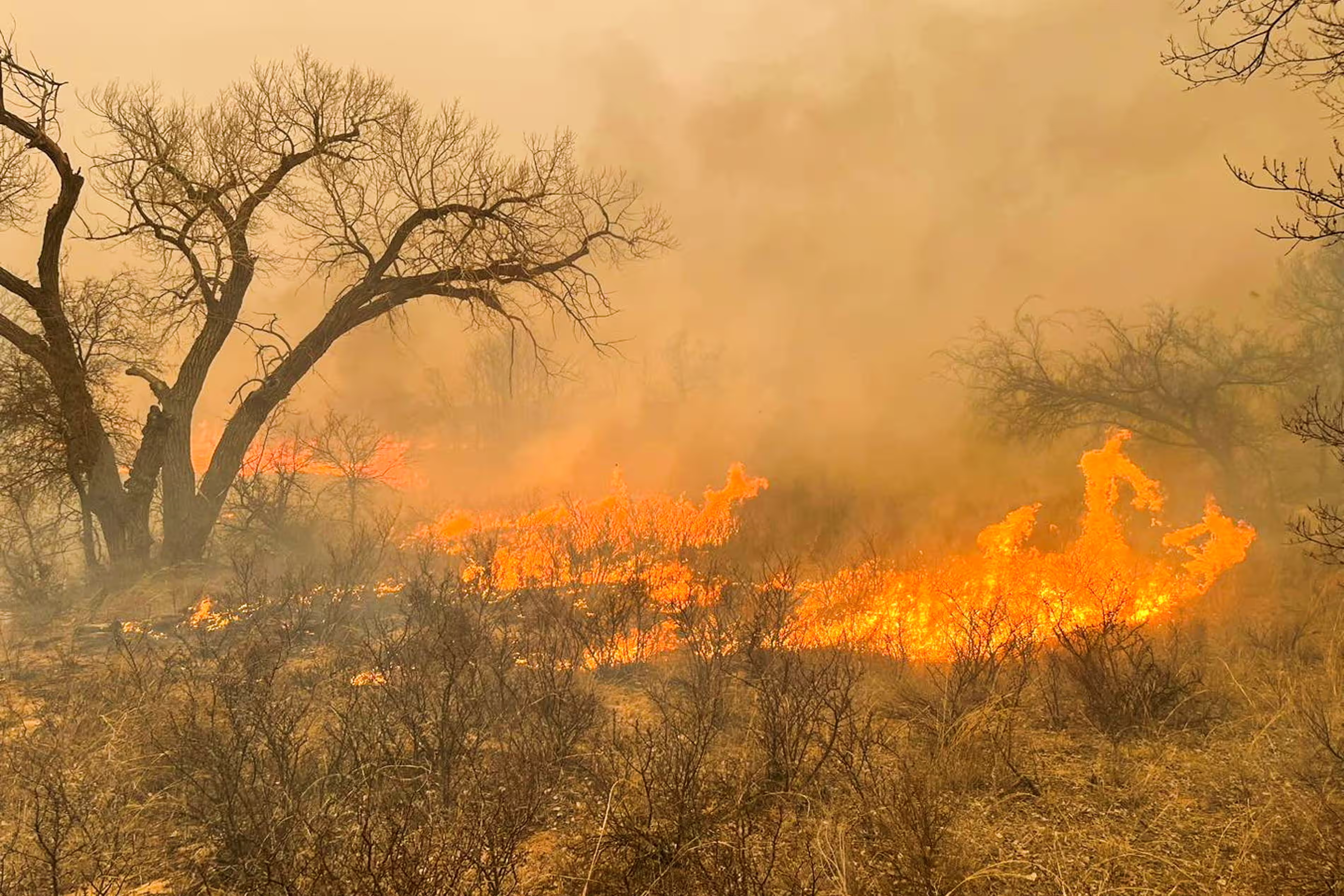
By Gloria Oladipo 28 February 2024 (The Guardian) – A historic wildfire in Texas continued to rage on Wednesday morning as firefighters work to contain the flames and survey damage. The Smokehouse Creek fire, the second largest wildfire in Texas to date, has consumed more than 500,000 acres in Texas’s Panhandle area since it ignited on Monday. […]
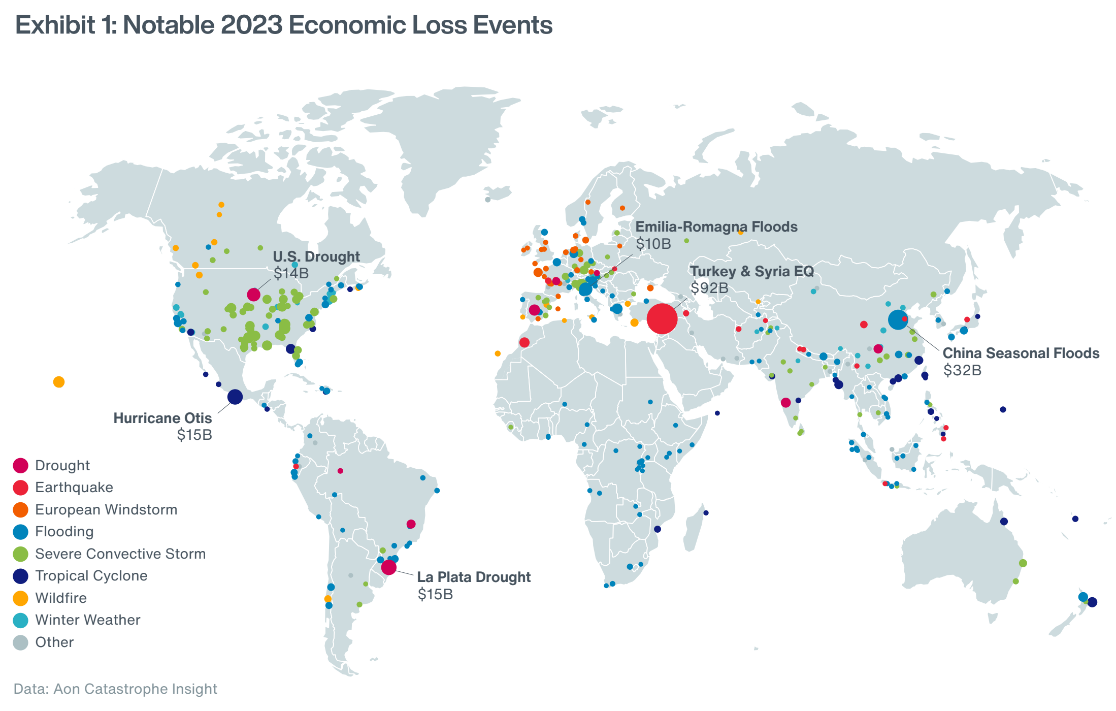
LONDON, 23 January 2024 (Aon) – Aon plc, a leading global professional services firm, today published its 2024 Climate and Catastrophe Insight report, which identifies global natural disaster and climate trends to help make better decisions to manage volatility and enhance global resilience. The report reveals that the 398 global natural disaster events caused a $380 billion (2022: $355 billion) […]
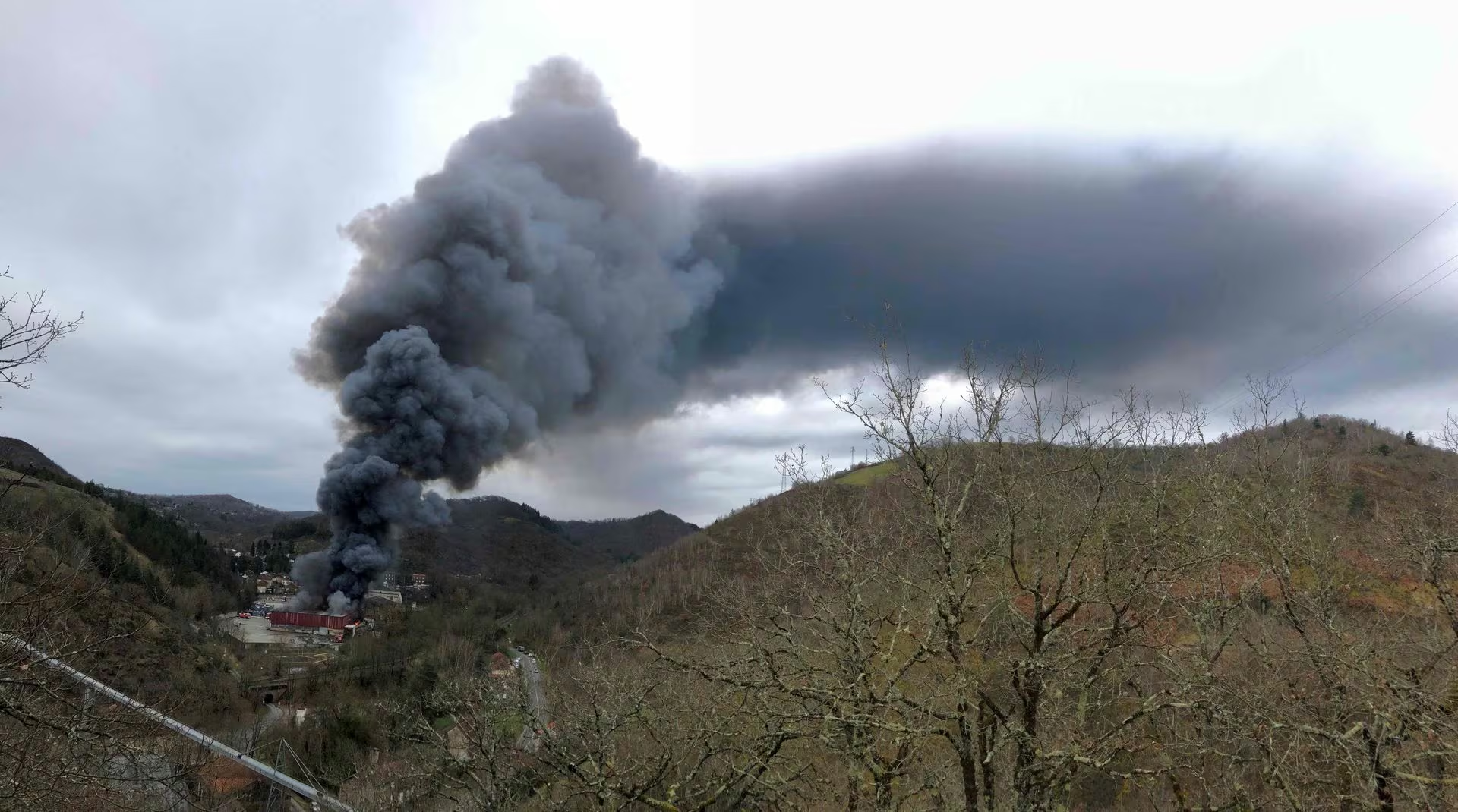
By Geert De Clercq and Ingrid Melander 19 February 2024 PARIS (Reuters) – A fire at a battery recycling plant in southern France is under control, though burning, the local firefighters service said on Monday, two days after the blaze began. The fire broke out in a warehouse containing 900 metric tons of lithium batteries […]
By Suman Naishadham 8 February 2024 WASHINGTON (AP) – A jury on Thursday awarded $1 million to climate scientist Michael Mann who sued a pair of conservative writers 12 years ago after they compared his depictions of global warming to a convicted child molester. Mann, a professor of climate science at the University of Pennsylvania, […]
By Julia Simon 6 February 2024 (NPR) – In a D.C. courtroom, a trial is wrapping up this week with big stakes for climate science. One of the world’s most prominent climate scientists is suing a right-wing author and a policy analyst for defamation. The case comes at a time when attacks on scientists are […]
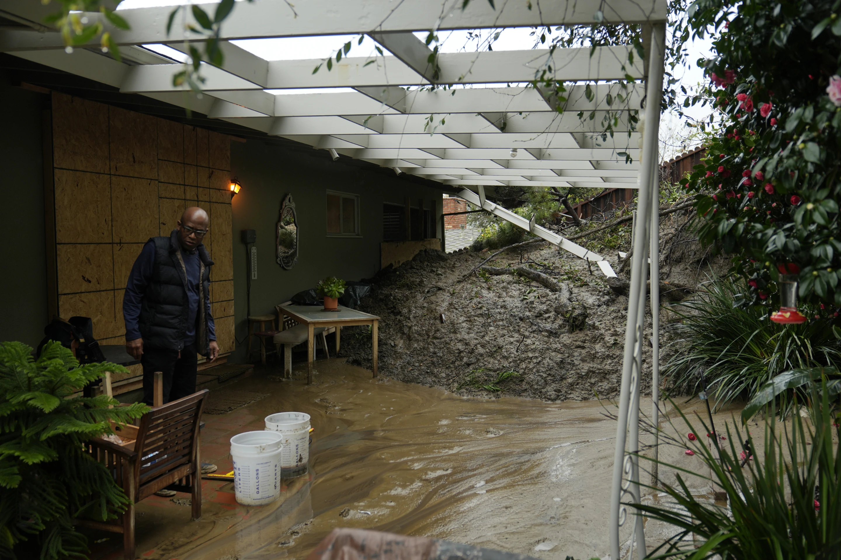
LOS ANGELES, 6 February 2024 (AP) – The slow-moving atmospheric river still battering California on Tuesday unleashed record rainfall, triple-digit winds and hundreds of mudslides. Here is the historic storm by the numbers: Downtown Los Angeles In just three days, downtown Los Angeles got soaked by more than 8 inches (20.3 cm) of rain — more than half […]
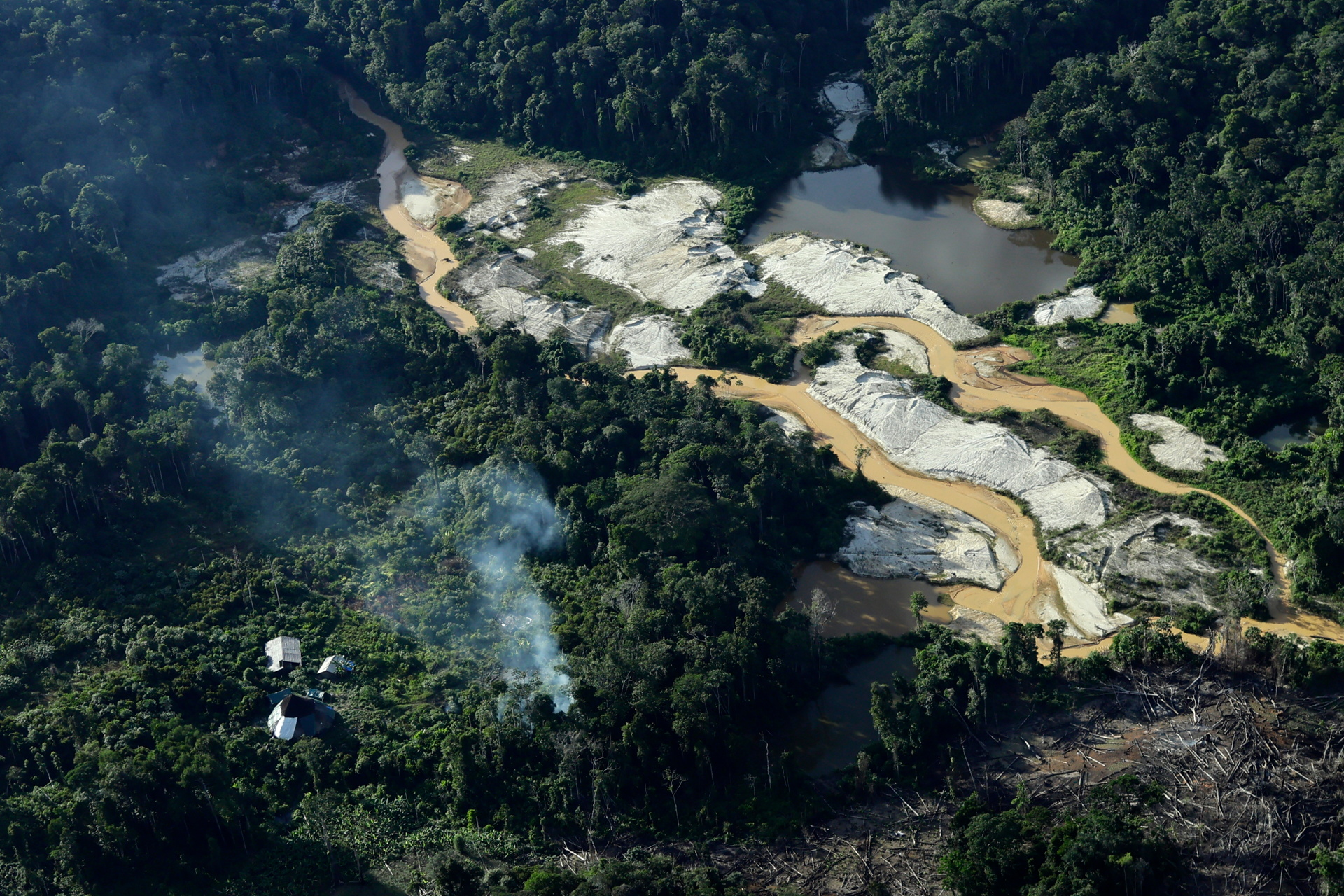
By Ueslei Marcelino and Anthony Boadle 18 January 2024 (Reuters) – Brazil is losing the upper hand in its battle to save the Yanomami Indigenous people, who are dying from flu, malaria, and malnutrition brought into their vast, isolated Amazon rainforest reservation by resurgent illegal miners. A year after President Luiz Inacio Lula da Silva […]
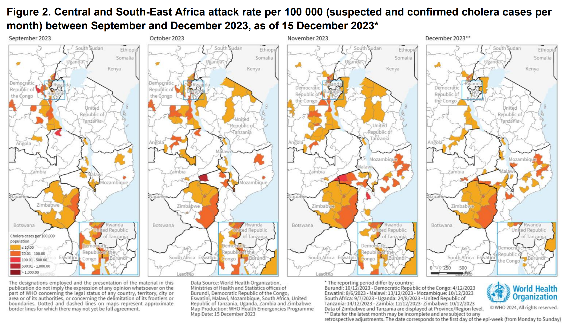
By Weronika Strzyżyńska 12 January 2024 (The Guardian) – Cholera cases soared last year, according to preliminary data from the World Health Organization, which recorded 4,000 cholera deaths and 667,000 cases globally. The numbers surpassed that of 2022, and the WHO has classified the global resurgence of cholera as a grade 3 emergency, its highest internal health […]
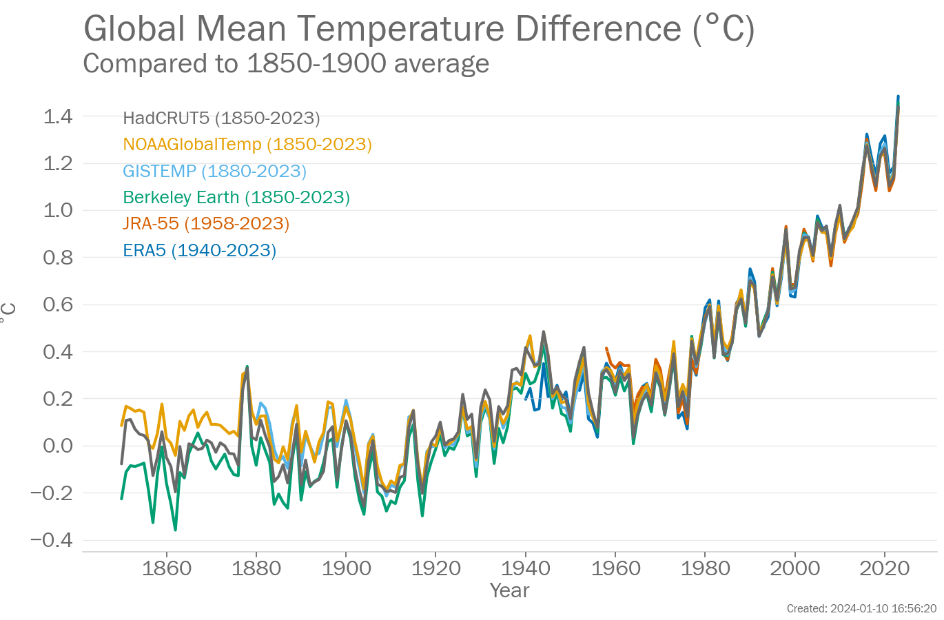
12 January 2024 (WMO) – The annual average global temperature approached 1.5° Celsius above pre-industrial levels – symbolic because the Paris Agreement on climate change aims to limit the long-term temperature increase (averaged over decades rather than an individual year like 2023) to no more than 1.5° Celsius above pre-industrial levels. Six leading international datasets used for […]
By Victoria Waldersee 11 January 2024 (Reuters) – Risk specialists see extreme weather and misinformation as most likely to trigger a global crisis in the next couple of years, a World Economic Forum (WEF) survey released on Wednesday said. While extreme weather was identified as the bigger risk in 2024, misinformation and disinformation came second […]